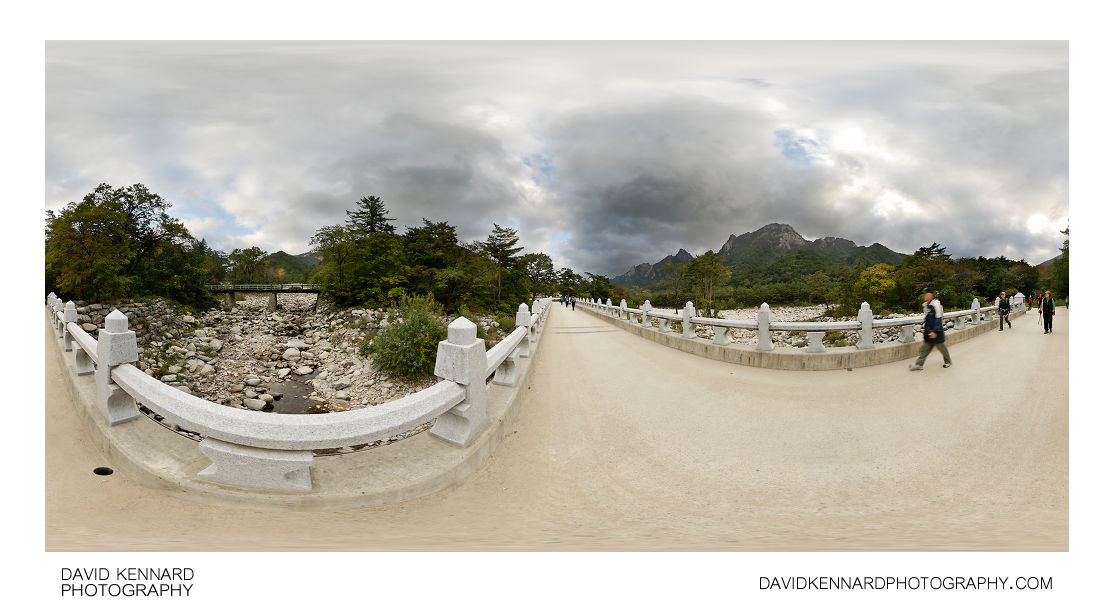
Bridge over dry river, Seoraksan National Park

Description
- Title:
- Bridge over dry river, Seoraksan National Park
- Caption / Description:
-
A bridge runs over the dry river to the south of Sinheungsa temple in Seoraksan National Park, South Korea.
From Wikipedia (http://en.wikipedia.org/wiki/Seoraksan_National_Park):
The nature reserve protects an area of 163.6 square kilometers and contains many notable high peaks measuring over 1,200 meters above sea level including the highest peak of Soraksan, Daecheongbong, which has an altitude of 1,708 meters. The nature reserve contains mountain ranges of dissected granite and gneiss and is characterized by spectacular rocky hills and ridges. The magnificent natural beauty of Soraksan and the mountain ridges is due to these geographical features. Annual precipitation in Inner Soraksan is 1000 millimeters and 1300 millimeters in Outer Soraksan. - Tags / Keywords:
-
- Asia
- 한국
- Hanguk
- 韓國
- Korea
- Taebaek Mountain Range
- 태백산맥
- Taebaek Sanmaek
- 太白山脈
- Gangwon-do
- 강원도
- 江原道
- Sokcho-si
- 속초시
- 束草市
- Seoraksan National Park
- 설악산국립공원
- 雪嶽山國立公園
- Seorak-dong
- 설악동
- 雪嶽洞
- 신흥교기점
Admin
- Date Original Photo Taken:
- Original File Name:
- Bridge near Sinheungsa temple.psb
- Event:
- Rating:
- ☆
- Date this image added/last updated on website:
- Original File Dimensions:
- 10512px x 5256px
- File Type:
- JPEG
- Color Mode:
- RGB
- Original Image Color Profile:
- Nikon Adobe RGB 4.0.0.3000
Location
- Location Shown:
-
- Sublocation:
- Seorak-dong 168-2
- City:
- Sokcho-si
- Province/State:
- Gangwon-do
- Country:
- Korea, Republic Of
- World Region:
- Asia
- Location Created:
-
- Sublocation:
- Seorak-dong 168-2
- City:
- Sokcho-si
- Province/State:
- Gangwon-do
- Country:
- Korea, Republic Of
- World Region:
- Asia
- Geo-location:
- 38.174118140194, 128.48550135456 View on map
Rights
- Copyright Status:
- Copyrighted
- Licensing Status:
- Rights Managed
- Available for Editorial Use:
- Yes
- Available for Commercial Use:
- No
- Copyright Notice:
- © 2009 Dave Kennard
Camera Data
- Date Digital Resource was created:
- Shutter speed:
- 1⁄40 s
- Aperture:
- f/8
- Camera Model:
- Nikon D200
- ISO:
- 100
- Exposure Compensation:
- 0
- Focal Length:
- 10mm
- Focal Length (35mm equiv.):
- 15mm
- Metering Mode:
- Multi-segment
- Flash:
- No Flash
- Exposure Mode:
- Manual
- White Balance:
- Manual
- Light Source:
- Cloudy
- Exposure Program:
- Manual
Additional shooting metadata
- Lens:
- Tokina ATX107 DX FishEye 10-17mm F3.5-4.5
- Filters used:
- Additional Optics used:
- Setup:
- Benro C-428 Tripod
Nodal Ninja 3 II Rotator and lower rail
Nodal Ninja 3 vertical arm and upper rail
Arca Swiss Compatible Quick Release Clamp
Remote shutter release
6 shots around, 1 up, 1 down, 1 down handheld, all bracketed ±1EV
Post Processing
- Image Modified:
- Software used:
-
- Nikon Capture NX 2
- Adobe Photoshop CS5
- PTGUI 9 Pro
- Post Processing:
NEFs converted with -0.3 exposure compensation in CNX2
Images (except handheld nadir) stitched, blended, and exposure fused in PTGUI 9 Pro
Handheld nadir stitched in PTGUI 9 Pro
EV+1, EV-1, and exposure fused images blended for exposure in PS CS5
Nadir patched with some cloning and curves adjustments to equalize exposure in PS CS5
LCE selectively applied in PS CS5
